


PERU - T 1 Voting District, Dunn County, Wisconsin
About
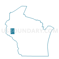
Outline

Summary
| Unique Area Identifier | 693536 |
| Name | PERU - T 1 Voting District |
| County | Dunn County |
| State | Wisconsin |
| Area (square miles) | 19.76 |
| Land Area (square miles) | 18.60 |
| Water Area (square miles) | 1.16 |
| % of Land Area | 94.13 |
| % of Water Area | 5.87 |
| Latitude of the Internal Point | 44.71998110 |
| Longtitude of the Internal Point | -91.81087330 |
Maps


Graphs
Select a template below for downloading or customizing gragh for PERU - T 1 Voting District, Dunn County, Wisconsin


Neighbors
Neighoring Voting District (by Name) Neighboring Voting District on the Map
- ALBANY - T 1 Voting District, Pepin County, WI
- DUNN - T 1 Voting District, Dunn County, WI
- DUNN - T 2 Voting District, Dunn County, WI
- DURAND - T 2 Voting District, Pepin County, WI
- LIMA - T 1 Voting District, Pepin County, WI
- ROCK CREEK - T 1 Voting District, Dunn County, WI
- SPRINGBROOK - T 1 Voting District, Dunn County, WI
- WAUBEEK - T 1 Voting District, Pepin County, WI
Top 10 Neighboring County Subdivision (by Population) Neighboring County Subdivision on the Map
- Spring Brook town, Dunn County, WI (1,558)
- Dunn town, Dunn County, WI (1,524)
- Rock Creek town, Dunn County, WI (1,000)
- Durand town, Pepin County, WI (742)
- Lima town, Pepin County, WI (702)
- Albany town, Pepin County, WI (676)
- Waubeek town, Pepin County, WI (423)
- Peru town, Dunn County, WI (242)
Top 10 Neighboring Unified School District (by Population) Neighboring Unified School District on the Map
- Eau Claire Area School District, WI (80,993)
- Menomonie Area School District, WI (26,904)
- Durand School District, WI (7,562)
- Elk Mound Area School District, WI (4,854)
Top 10 Neighboring State Legislative District Lower Chamber (by Population) Neighboring State Legislative District Lower Chamber on the Map
- Assembly District 67, WI (58,722)
- Assembly District 93, WI (57,822)
- Assembly District 91, WI (56,636)
Top 10 Neighboring State Legislative District Upper Chamber (by Population) Neighboring State Legislative District Upper Chamber on the Map
Top 10 Neighboring 111th Congressional District (by Population) Neighboring 111th Congressional District on the Map
Top 10 Neighboring Census Tract (by Population) Neighboring Census Tract on the Map
- Census Tract 9704, Dunn County, WI (6,094)
- Census Tract 9706, Dunn County, WI (4,128)
- Census Tract 9501, Pepin County, WI (4,051)
- Census Tract 9502, Pepin County, WI (3,418)